


Doddridge Precinct, Miller County, Arkansas
About
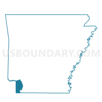
Outline

Summary
| Unique Area Identifier | 527303 |
| Name | Doddridge Precinct |
| County | Miller County |
| State | Arkansas |
| Area (square miles) | 61.09 |
| Land Area (square miles) | 60.31 |
| Water Area (square miles) | 0.78 |
| % of Land Area | 98.72 |
| % of Water Area | 1.28 |
| Latitude of the Internal Point | 33.08655870 |
| Longtitude of the Internal Point | -93.90120560 |
Maps


Graphs
Select a template below for downloading or customizing gragh for Doddridge Precinct, Miller County, Arkansas


Neighbors
Neighoring Voting District (by Name) Neighboring Voting District on the Map
- Bright Star Precinct, Miller County, AR
- Fort Lynn Precinct, Miller County, AR
- Gin City Voting District, Lafayette County, AR
- Precinct 146, Caddo Parish, LA
- Precinct 149, Caddo Parish, LA
- Precinct 150, Caddo Parish, LA
- Precinct 3-2, Bossier Parish, LA
Top 10 Neighboring County Subdivision (by Population) Neighboring County Subdivision on the Map
- District 1, Caddo Parish, LA (20,040)
- District 4, Bossier Parish, LA (8,974)
- Beech township, Miller County, AR (3,773)
- Roane township, Lafayette County, AR (1,498)
- Sulphur township, Miller County, AR (1,496)
Top 10 Neighboring Place (by Population) Neighboring Place on the Map
Top 10 Neighboring Unified School District (by Population) Neighboring Unified School District on the Map
- Caddo Parish School District, LA (254,969)
- Bossier Parish School District, LA (116,979)
- Fouke School District, AR (5,782)
- Bradley School District, AR (2,342)
Top 10 Neighboring State Legislative District Lower Chamber (by Population) Neighboring State Legislative District Lower Chamber on the Map
Top 10 Neighboring State Legislative District Upper Chamber (by Population) Neighboring State Legislative District Upper Chamber on the Map
- State Senate District 36, LA (119,479)
- State Senate District 39, LA (107,940)
- State Senate District 21, AR (74,633)
Top 10 Neighboring 111th Congressional District (by Population) Neighboring 111th Congressional District on the Map
Top 10 Neighboring Census Tract (by Population) Neighboring Census Tract on the Map
- Census Tract 210, Miller County, AR (8,063)
- Census Tract 112, Bossier Parish, LA (6,273)
- Census Tract 4702, Lafayette County, AR (2,917)
- Census Tract 251, Caddo Parish, LA (2,048)